
Mining, construction & infrastructure
Drone inspections and survey support for complex sites.
Drone Division provides efficient aerial visual data capture for progress documentation, inspections, mapping and site assessment in Gqeberha | Port Elizabeth and across the Eastern Cape.
Start a project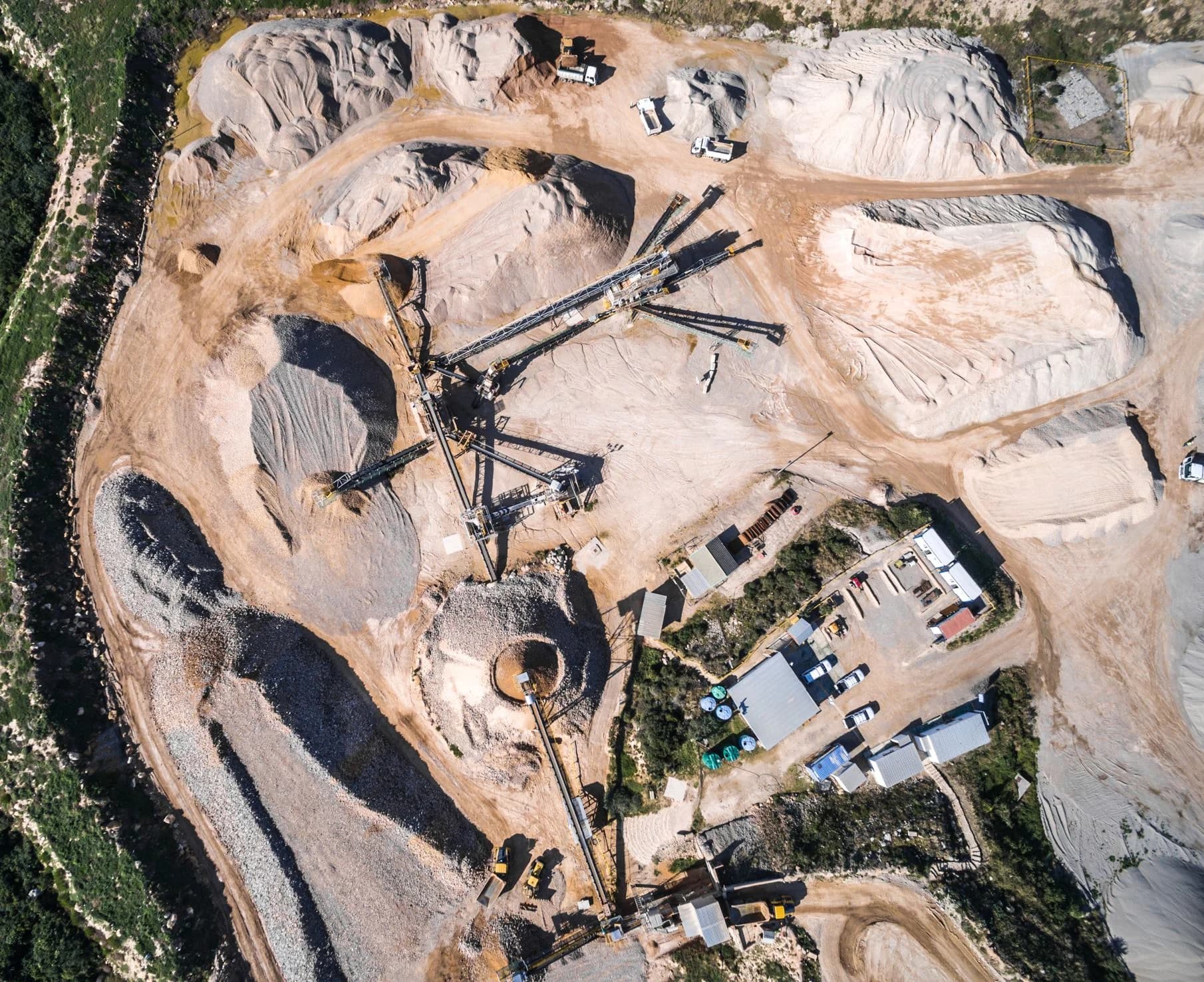
Operational overview
A clearer view of the site.
Aerial imagery gives project teams a useful overview of sites, structures and changing work areas. We capture the agreed visual material around the project brief, intended use and practical requirements of the location.
Drone capture can support non-invasive assessment of areas that are difficult to view safely or efficiently from the ground. The required coverage is agreed before flight so the operation remains focused and repeatable.
Capabilities
Inspection and survey support
High-resolution visual capture for industrial teams, project records and ongoing site communication.
Mining & construction
Site overviews, work-area documentation and repeatable progress imagery across active environments.
Structures & utilities
Visual inspection support for infrastructure, assets and areas that are difficult to view from the ground.
Mapping & site context
Aerial imagery that helps communicate layout, access, change and the relationship between site elements.
Progress documentation
Organised stills and video for project records, internal reporting and stakeholder communication.
How we work
Planned for the site
The intended output, working environment and site procedures shape the operation before the aircraft is deployed.
- 01
Define the requirement
The project team identifies the location, areas to cover, intended use, preferred dates and required visual outputs.
- 02
Assess the operation
We review site procedures, airspace, hazards, access, weather, aviation requirements and capture method.
- 03
Capture & organise
The agreed imagery is captured methodically and delivered in a clear structure suited to the project workflow.
Focused visual capture
Efficient access from the air.
The aerial viewpoint can reduce the time needed to obtain visual context across large or difficult areas. It complements the project team’s technical process; the exact scope and intended use of the imagery are confirmed before flight.
Eastern Cape operations
Local support, wider reach.
Based in Gqeberha | Port Elizabeth, our team supports mining, construction, infrastructure and industrial projects throughout the Eastern Cape and further afield, subject to site and aviation requirements.
Project enquiries
Need aerial data from a site?
Share the location, intended use, areas to be captured and preferred dates. We’ll review the operational requirements and suitable aerial approach.
Discuss your site brief